Category:Lea, Wiltshire
Jump to navigation
Jump to search
village in Wiltshire, England  | |||||
| Upload media | |||||
| Instance of | |||||
|---|---|---|---|---|---|
| Location | Lea and Cleverton, Wiltshire, South West England, England | ||||
| official website | |||||
 | |||||
Media in category "Lea, Wiltshire"
The following 13 files are in this category, out of 13 total.
-
 Kingsmead crossing - geograph.org.uk - 314313.jpg 605 × 380; 119 KB
-
 Lea, Wiltshire - geograph.org.uk - 65259.jpg 640 × 480; 88 KB
-
 Manor farm - geograph.org.uk - 302146.jpg 640 × 480; 112 KB
-
 National grid, Brinkworth - geograph.org.uk - 379625.jpg 640 × 430; 59 KB
-
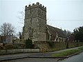 St. Giles Church, Lea - geograph.org.uk - 103482.jpg 640 × 481; 43 KB
-
 Charlton Park 2 - geograph.org.uk - 1423237.jpg 640 × 480; 123 KB
-
 Charlton Park pasture 1 - geograph.org.uk - 1423200.jpg 639 × 479; 103 KB
-
 Chink Farm - geograph.org.uk - 103487.jpg 640 × 481; 47 KB
-
 Firs farm - geograph.org.uk - 302120.jpg 640 × 461; 57 KB
-
 Lea and Garsdon Primary school - geograph.org.uk - 311301.jpg 600 × 409; 126 KB
-
 Malthouse farm - geograph.org.uk - 319158.jpg 640 × 443; 76 KB
-
 River Avon from Cow bridge - geograph.org.uk - 302128.jpg 640 × 480; 97 KB
-
 Stone house - geograph.org.uk - 302125.jpg 640 × 480; 77 KB


